Bulk changing symbology using ArcGIS Pro
Geographic Information Systems Asked on September 5, 2021
I’m currently processing a land classification map which is in feature class format. This map is symbolised by a defined color for each land class (yellow for sand, green for vegetation and blue for water).
Every time I conduct a process, I need to re-assign the symbology to the output.
Is there anyway I can re-apply the same colors from one feature class to another without having to manually selecting each colour one-by-one?
One Answer
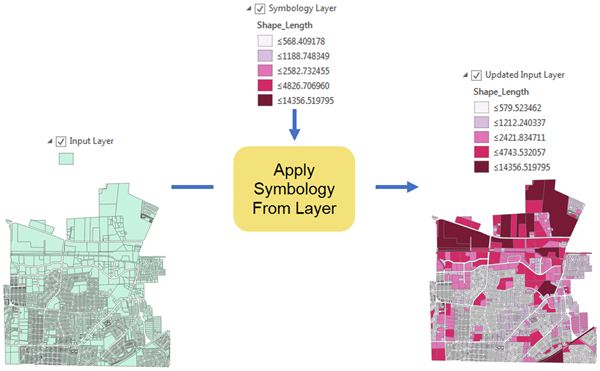
You can use the Apply Symbology From Layer (Data Management) tool:
Applies the symbology from a layer or layer file to the input. It can be applied to feature, raster, network analysis, TIN, and geostatistical layers.
To do a bulk update, you can use the standard ArcGIS Pro batch functionality - right click the tool and select "Batch".
Correct answer by user2856 on September 5, 2021
Add your own answers!
Ask a Question
Get help from others!
Recent Questions
- How can I transform graph image into a tikzpicture LaTeX code?
- How Do I Get The Ifruit App Off Of Gta 5 / Grand Theft Auto 5
- Iv’e designed a space elevator using a series of lasers. do you know anybody i could submit the designs too that could manufacture the concept and put it to use
- Need help finding a book. Female OP protagonist, magic
- Why is the WWF pending games (“Your turn”) area replaced w/ a column of “Bonus & Reward”gift boxes?
Recent Answers
- Joshua Engel on Why fry rice before boiling?
- Lex on Does Google Analytics track 404 page responses as valid page views?
- Peter Machado on Why fry rice before boiling?
- Jon Church on Why fry rice before boiling?
- haakon.io on Why fry rice before boiling?
